En
En  Es
Es  De
De Inka Trail + machupicchu + Huayna Picchu 5 days Tour
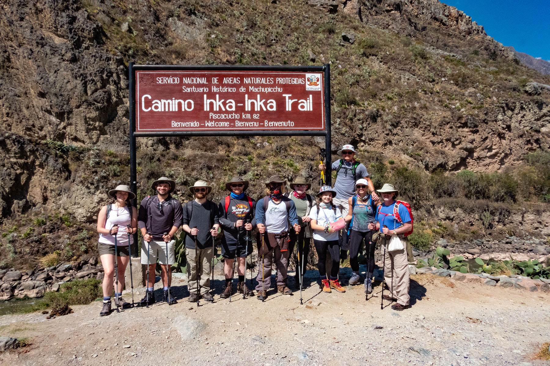
The Inka Trail "Camino Inka", was used by the Incas to reach Machu Picchu and is also the most famous trek in Peru today for tourists trying to reach it on foot, it is considered sacred and during the trek starting at Km 43 you can see many archaeological sites such as Llaqtapata, Runkuraqhay and Wiñayhuayna before reaching the sacred citadel of Machu Picchu, but first we will enjoy the very impressive natural scenery, with incredible views of snow-capped mountains and cloud forest.
The Inca Trail starts from a point in the Sacred Valley, called "Kilometer 82". To begin the trek, you cross a narrow bridge at Kusicancha. This trek is not suitable for people with heart conditions as you will pass over 4,600 m.a.s.l., the trail winds up, down and around the mountains on ancient carved stone stairways, and then continues over three high Andean mountain passes, one of them hauntingly named, "Dead Woman's Pass". Once at the top, when you are able to catch your breath, you are sure to be amazed again by the truly spectacular views of the snow-capped mountains of the Vilcanota Range. Along the way, visitors will be able to experience a series of microclimates and observe the changes in flora and fauna, typical of the Andes and the cloud forest, as well as the enormous biological diversity of the Amazon.
The 5 -days Inca Trail to Machu Picchu
The Inca Trail got used as a communication system for the Incas to run from one place to another in the humongous Inca Empire which stretched from south Colombia to north of Argentina. There are different Inca trails to hike, but this one is the most famous Inca trail and it will take you from Sacred Valley to Machu Picchu which is one of the Seven Wonders of the World, through beautiful landscapes and different archaeological Inca sites.
Our departure dates for the Inca Trail range from March to January. Our recommended period being April to October due to the rainy season. The Inca Trail has a strict limit on the number of people alowed (500), with three hundred of them are the guides, porters and chefs. Therefore we will recommend booking your trip as early as possible, ideally around 6 months in advance.
The real Inca Trail covers more than 32,952 hectares, various networks of Inca roads, dozens of archaeological sites, ten ecological zones, over 450 bird species, and 200 species of orchids, in addition to the Sanctuary of Machu Picchu.
Day 01: Cusco | Ollantaytambo – Piscacucho, Km 82 – Llactapata view – Wayllabamaba
Day 02: Wayllabamaba – Warmiwañusca "Dead Woman's pass" – Pacaymayo
Day 03: Pacaymayo – Runkurakay - Phuyupatamarca – Inti Pata – Wiñayhuayna
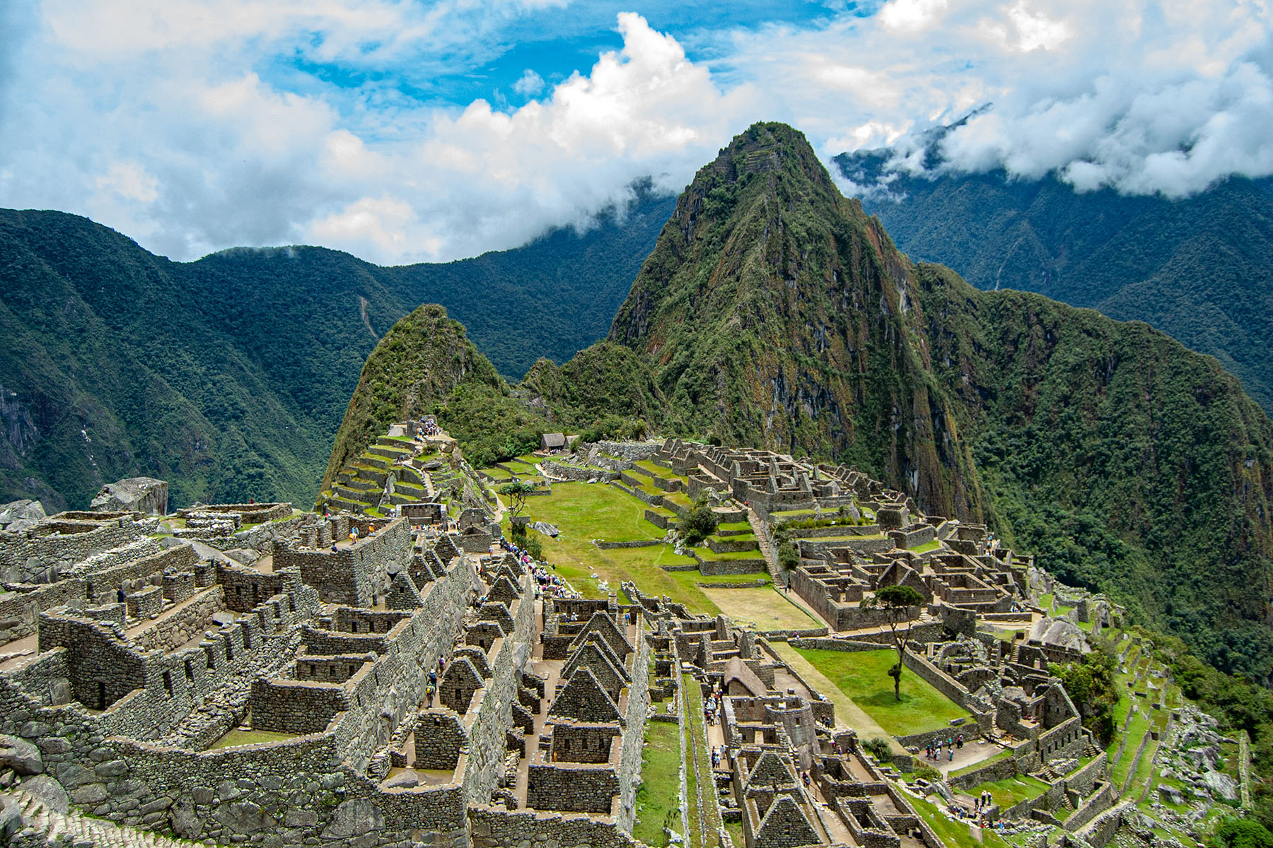
Day 04: Wiñayhuayna – Inti Punku "Sun Gate" – Machu Picchu .
Day 05: Aguas Calientes to Machupicchu, Huaynapicchu Mountain or Machupicchu Mountain.
DAY 1: Cusco - Piscacucho – Wayllabamba
veryone is collected early from their hotels and we all travel by bus for a bit more than three hours, passing by the picturesque villages of Chinchero, Urubamba and Ollantaytambo, until reaching the kilometer 82, the actual start of the trail.
We start our trek escorted by native "Quechua" porters going through semi-arid terrain along the Urubamba River valley, with magnificent views of the snowcapped mountain, Veronica (5822 meters).
We cross the Vilcanota River and follow the trail to the right as it climbs steeply up from the river. After passing through a small village, the ruins of the Inca hillfort of Huillca Raccay come into view high above the mouth of the river Cusichaca ("Happy Bridge"). It is then a simple descent down to the Cusichaca River.
For a further 7 km the path follows the left bank of the river up to the village of Wayllabamba (3,000 meters). The name in Quechua means "Grassy plain". We spend the first night here beside some spectacular ruins which, if you have the energy, we have time to explore.
· Walking Distance – 11kms/6.8 miles
· Starting Elevation – 2700 meters ASL / 8858.268 feet ASL
· Highest Elevation – 3000 meters ASL / 9842.52 feet ASL
· Campsite Elevation – 3000 meters ASL / 9842.52feet ASL
· Difficulty:Easy/Moderate.
DAY 2: Wayllabamba - Llulluchapampa – Pacaymayu
After a delicious breakfast, we start our second day of trekking, perhaps the most difficult, as we have to climb to the pass of the impressive Warmihuañusca ("Dead woman´s Pass") at 4,200 meters high. In this place, the highest in the Inca Trail, we enjoy a spectacular view of the Andes. The path continues on following a mountain stream up past hummingbirds and amazing stunted cloud forest. We pass by the beautiful grassy area at Llulluchapampa (3680 meters), which also possesses outstanding views down the valley.
After lunch, we start the descent towards the valley of Pacaymayu, where we make our second camp.
· Walking Distance – 16kms/10 miles
· Starting Elevation – 3000 meters ASL / 9842.52 feet ASL
· Highest Elevation – 4200meters ASL / 13779 feet ASL
· Campsite Elevation – 3600meters ASL / 11811.02 feet ASL
· Difficulty: Moderate/challenge.
· Accommodation: Camping facilities.
DAY 3: trekking Pacaymayu to Winayhuayna
From Pacaymayu it takes about an hour to climb up to the ruins of Runkuracay. These small circular ruins occupy a commanding position overlooking the Pacaymayu valley below. Another 45 minutes´ hike brings you to the top of the second pass: Abra de Runkuracay (4,000 meters). At last you feel that you are walking along the trail of the Incas with preserved paving for the most part.
The descent down the steps from the pass is steep so take care. This section of the trail, up till the 3rd pass, is particularly beautiful as the path crosses high stone embankments and deep precipices. After about 1 hour from the 2nd pass you arrive at Sayacmarca by way of a superbly designed stone staircase. The name Sayacmarca means "Inaccessible Town" and describes the position of the ruins perfectly, protected on three sides by sheer cliffs. Even though till this very day no one knows the exact purpose of these ruins.
You have to back track a little to rejoin the trail as it passes Conchamarca, a small Inca dwelling situated in the shadows of Sayacmarca, which was probably a Tambo for weary travelers on their way to Machu Picchu.
· Walking Distance – 10kms/6.2 miles
· Starting Elevation – 3600meters ASL / 11811.02 feet ASL
· Highest Elevation – 4000 meters ASL / 13123.36 feet ASL
· Campsite Elevation – 2600meters ASL / 8530.184 feet ASL
· Difficulty: Moderate
· Accommodation: Camping facilities and hot showers.
DAY 4: Trekking winayhuayna – Intipunku
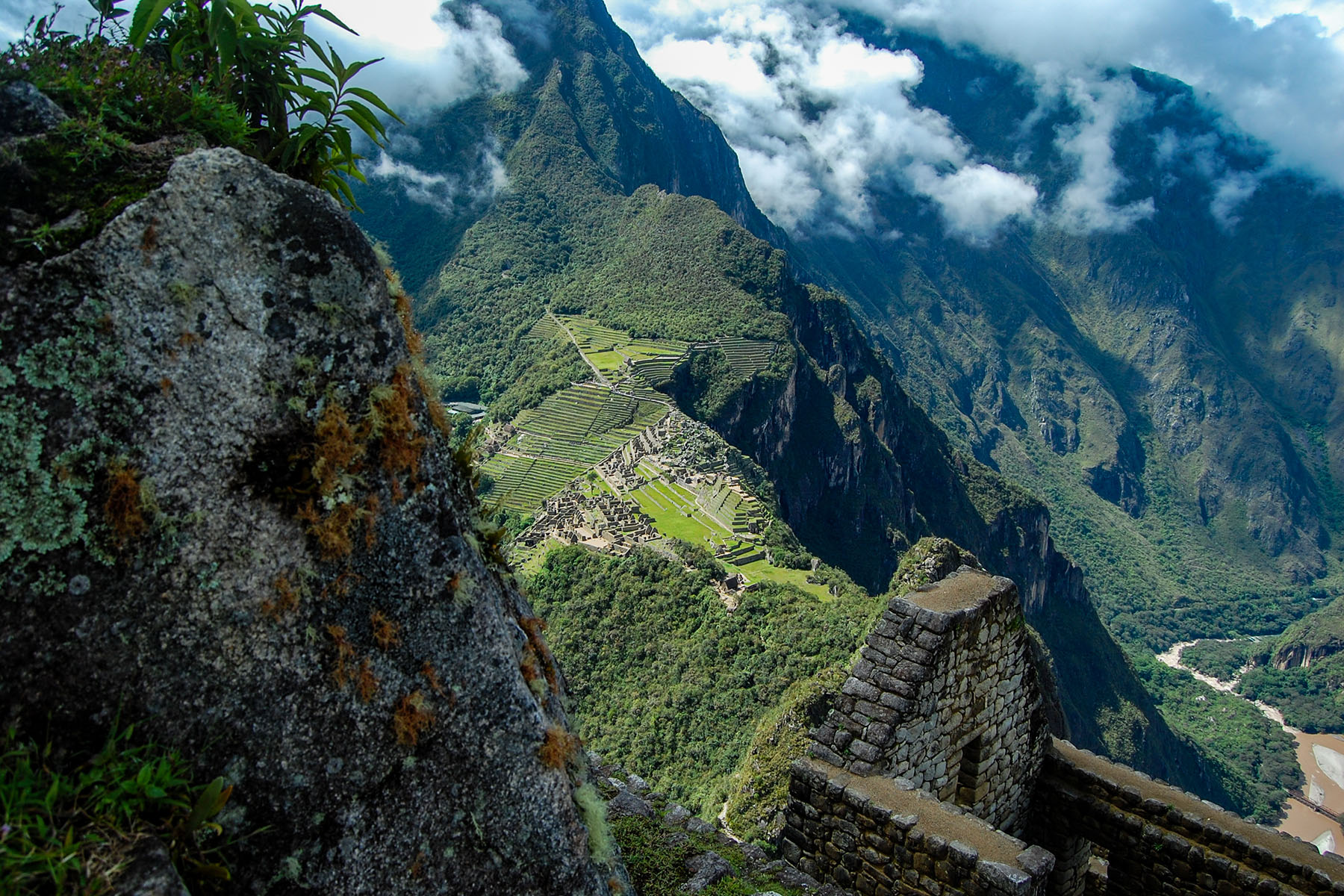
fter an early morning chance to catch the sunrise on the surrounding snowcapped mountains of Salcantay and Veronica, we offer a farewell to our porters with a traditional song and dance. Our final day of hiking brings us down the cloud forest on a series of Inca stairs to Winay Wayna, another interesting ruin full of swallows and orchids. Finally we reach Inti Punku, the gateway of the Sun and our first glimpse of Machu Picchu. We pass through the ruins and catch a bus down to our hotel in the colorful town of Machu Picchu Pueblo (formally known as Aguas Calientes) and celebrate our return to civilization.
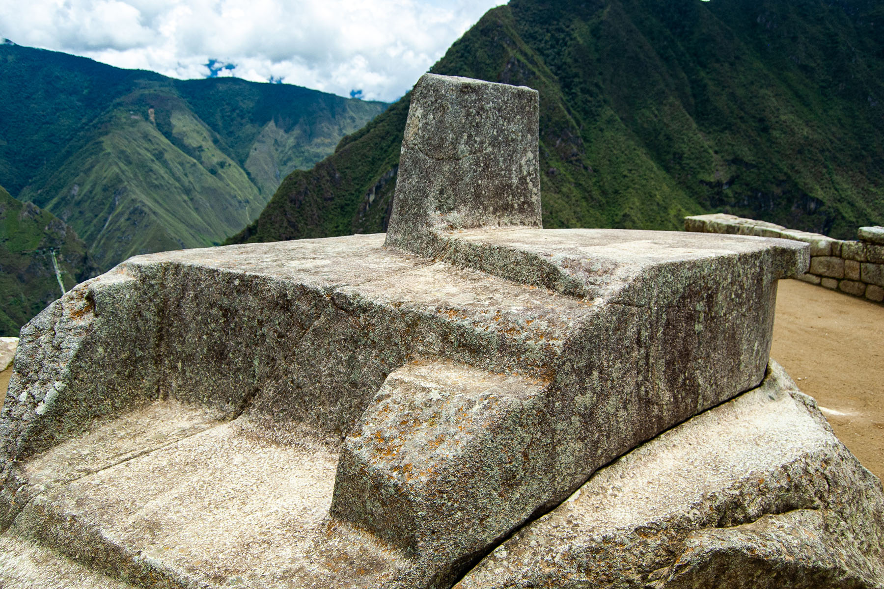
In the late morning we have Machu Picchu virtually to ourselves for a full guided tour, after which you have a couple of hours for more exploring on your own, or just collapse under a tree in the central plaza area. If you are exhausted from so much walking just stay in Aguas Calientes and enjoy its hot springs as you have a second opportunity to see all of Machu Picchu well rested the day after!
Machupicchu is officially open from 6 am to 5:30 pm so could also soak in the hot springs in the afternoon or evening after you Machu Picchu tour.
· Walking Distance – 6kms/3.7 miles
· Starting Elevation – 2600 meters ASL / 8530.184feet ASL
· Highest Elevation – 2700 meters ASL / 8858.268feet ASL
· Difficulty:Easy
· Meals: Breakfast
· Accommodation: Hotel
DAY 5: Aguas Calientes to Machupicchu,Huaynapicchu Mountain or Machupicchu Mountain
After an early breakfast you can walk or take the bus back up to explore more of Machu Picchu and of course go for your climb of Huayna Picchu or Machu Picchu Mountain. If you were tired yesterday then this is the right time to really capture Machu Picchu today so better start out early as buses are available from 5:30 am and depart every 10 minutes.
You can store your backpack in your hotel and make sure you get back down to Aguas Calientes at least an hour before your train departure which is generally at 6:45 pm but you should recheck this with your guide on day 4. Grab some snacks and drinks before boarding the train as the journey back to Cusco is about 4 hours long!
· Walking Distance – 2.5km / 1553.50miles
· Starting Elevation – 2400 meters ASL / 7874.016 feet ASL
· Highest Elevation – 2700 meters ASL / 8858.268 feet ASL
· Difficulty: Easy
Included:
- Tour guide in English, Spanish or German
- Transportation (bus, train)
- Cook
- Three meals a day
- All Nights in Tent Camp
- Snacks
- Entrance fee to Machupicchu National Park
- Train Tickets
- First aid kit
- Oxygen Tank
Excluded:
- Travel Insurance
- First breakfast
- Mineral water
- Last day Dinner
- Alcoholic beverages
- Tips for the team
- January :Every Day
- February:Close for Maintenance
- March:Every Day
- April:Every Day
- May:Every Day
- June:Every Day
- July:Every Day
- August: Every Day
- September:Every Day
- October: Every Day
- November:Every Day
- December:Every Day
Four days later, hikers will arrive at the magnificent city of Machu Picchu, discovered more than 100 years ago by an American professor by the name of Hiram Bingham. Arriving at Machu Picchu in the morning and watching the sunrise is a sight to behold and completing the Inca Trail is one of the best feelings in the world! Once in Machu Picchu you must choose to climb to the top of Huayna Picchu for an incomparable view of the Historic Sanctuary (Machi Picchu), the neighboring town of Aguas Calientes and the Urubamba Valley.
Difficulty level: Easy
Maximum altitude: 3000m
Minimum altitude: 2600m
Distance covered: 9 km
Approximate walking time: 5-6 hours
Wayllabamba - Warmiwañusca - Paccaymayu Pass
Difficulty level: Difficult
Maximum altitude: 4600m
Minimum altitude: 3000m
Distance covered: 12KM
Approximate trekking time: 6-7 hours
Paccaymayu - Runkuraqhay Pass - Phuyupatamarka - Wiñayhuayna
Difficulty level: moderate
Maximum altitude: 4000m
Minimum altitude: 2650m
Distance covered: 16 km
Approximate trekking time: 8 hours
Wiñayhuayna - Inti Punku (Perta del sol) - Machu Picchu - Aguas Calientes - Ollantaytambo - Cusco
Difficulty level: Easy
Maximum altitude: 2650m
Minimum altitude: 2100m
Distance covered: 6 km
9.3
Tour Score
Get Best Offer
Let us help you choose the best vacation out of plenty tours
Subscribe
Stay tuned for the latest offers available!